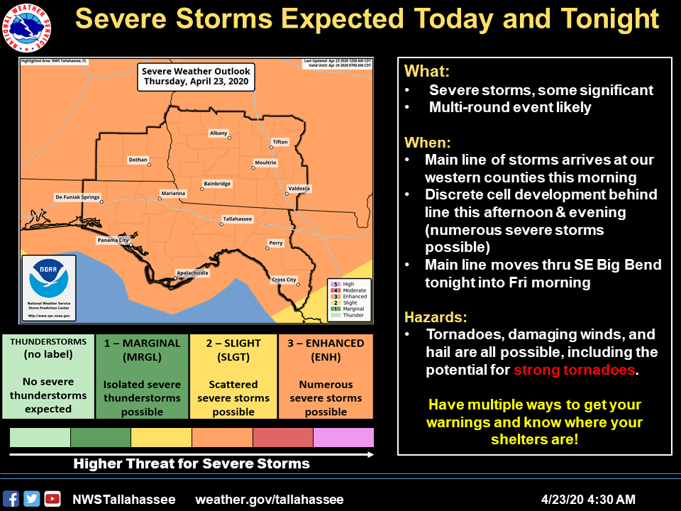
Bottom Line:
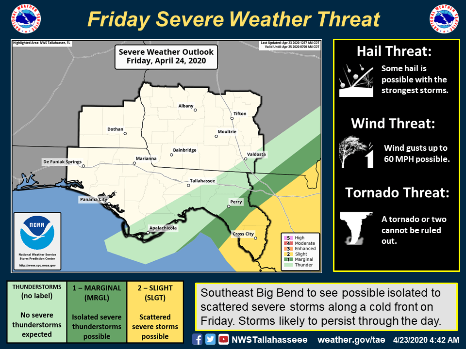
No major changes from previous forecasts. The Storm Prediction Center continues the enhanced risk for severe weather across the area today and tonight, and introduces a slight risk across the eastern Big Bend counties Friday. We are expecting severe weather beginning this morning and transitioning east with time today and tonight, and a lingering severe risk across the eastern Big Bend into Friday. All severe weather threats remain in play, including a strong tornado or two.
Overview:
The initial line of thunderstorms will arrive into southeast Alabama and the western Florida panhandle early to mid morning then progress eastward with time and reaching the I-75 corridor of Georgia by early afternoon. Behind this initial line, scattered to numerous thunderstorms will continue to develop area-wide. Further west into southern Mississippi and Alabama, another line of storms is expected to form later this afternoon and move eastward into our area this evening. In essence, three rounds of severe weather is possible before the cold front arrives into our western sections overnight.